01 · REVIEW
Inputs and reference systems
Inspect dataset completeness, coordinate metadata, trajectory or image references, file segmentation and the requested output schema.

GeoProcess Consulting supports downstream processing of mobile-mapping datasets supplied by clients. Depending on the available inputs and specification, work may include point-cloud organization, classification, feature extraction, mapping layers and QA/QC for corridor or asset programs.
 POINT CLOUD
ENGINEERING DATA
GIS INTELLIGENCE
Mobile mapping may combine dense point clouds, imagery and positioning information. Processing should preserve the source coordinate reference, trajectory context and required feature attributes while preparing consistent outputs for the next system.
Inspect dataset completeness, coordinate metadata, trajectory or image references, file segmentation and the requested output schema.
Organize point-cloud data and extract required assets or mapped features according to the project-defined classes and attributes.
Prepare structured outputs, review spatial alignment, check feature completeness and document exceptions or data gaps.
Mobile mapping data can combine LiDAR, imagery and a positioning trajectory. The processing workflow must consider sensor alignment, trajectory quality, occlusion and how features will be consumed by GIS, CAD or asset teams.
Check coordinate reference, trajectory coverage, strip consistency and obvious offsets. GNSS/IMU quality and synchronization influence how well the point cloud fits mapped features.
Prepare requested classes or features such as road edges, signs, poles, kerbs, façades, vegetation, street furniture and selected corridor assets when the source data supports them.
Deliver organized point clouds, vector layers, inventory attributes and exception notes in formats and schemas agreed for the client's asset system.
Features behind vehicles, inside dense vegetation or outside the sensor field of view may be incomplete. We identify coverage gaps rather than imply every asset is present in the source scan.
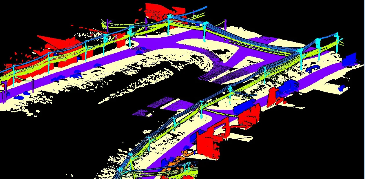
Illustrative outputs from related geospatial workflows. Final deliverables are agreed to the project specification.

This service page describes processing support for supplied data; it does not claim GeoProcess Consulting provides mobile mapping vehicles or field acquisition.